
Garland ZIP Code Directory Areas
Garland’s official ZIP map identifies five geographic areas in the city’s mapped service area. They are a useful local reference for a Garland ZIP code directory, but they are not a USPS delivery guarantee or a legal boundary. The table keeps the city-map geography separate from postal assignment. The official material reviewed does not supply a current named station for every ZIP, so no station names are inferred here.
| ZIP | Areas Covered | Post Office | Notes |
|---|---|---|---|
| 75044 | Northwest Garland | USPS Garland association / exact address controls | Check the street address near municipal edges. |
| 75042 | West-central Garland | USPS Garland association / exact address controls | The mapped area is not a city-limit line. |
| 75040 | Central and east-central Garland | USPS Garland association / exact address controls | Use an exact USPS result before relying on the map area. |
| 75041 | Southwest and central Garland | USPS Garland association / exact address controls | Postal bulletins discuss related delivery routing. |
| 75043 | Southeast and east Garland | USPS Garland association / exact address controls | Check current delivery results and city or county context. |
The five ZIPs above are the city map’s geographic areas. Related delivery ZIPs require a different treatment. They can be associated with a Garland postal label or route history without creating additional city polygons or proving that an address lies inside the City of Garland.
Garland ZIP Code Lookup Steps
Use the postal address first, not a neighborhood assumption. USPS ZIP Code Lookup has two distinct modes: an address mode using street, city, and state, and a city/state mode that returns ZIP codes associated with the named city and state. USPS warns that a returned ZIP does not confirm a person or company at that address. It confirms a delivery lookup result, which is the right starting point for a geographic check.
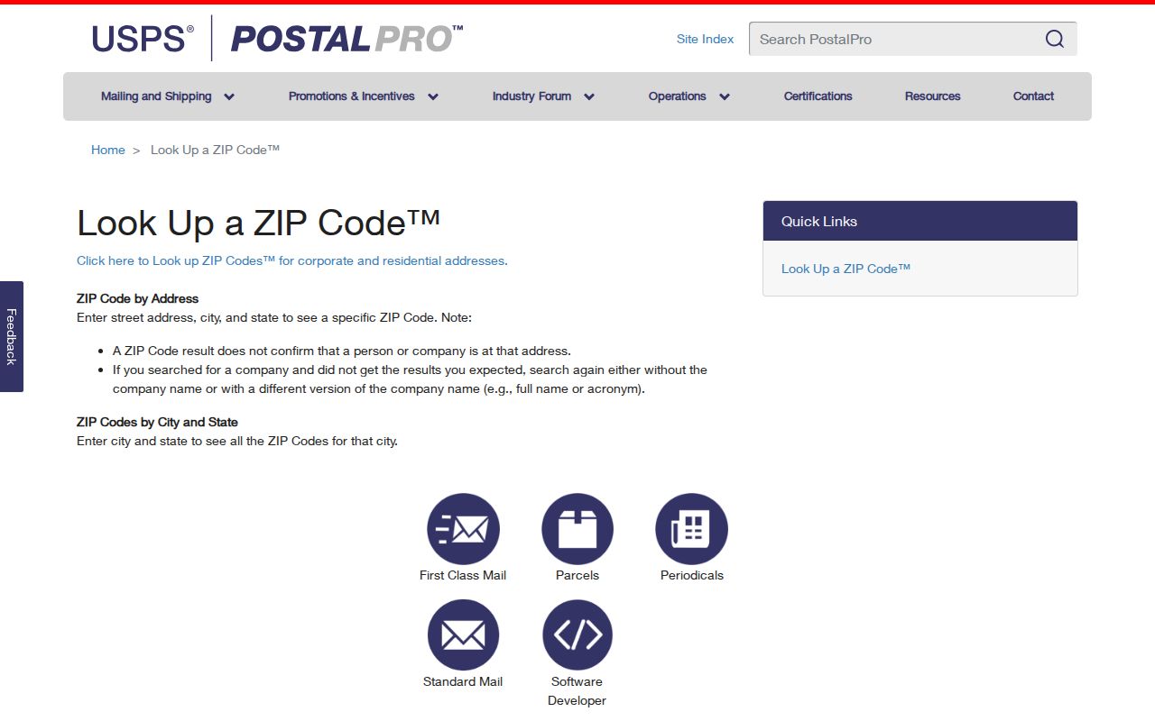
The USPS screen shows why the two modes should not be confused. A city/state list is broader, while an exact address result is the postal control for one delivery point. Save the returned ZIP and the date checked, especially when comparing an older newspaper, directory, or deed reference.
- Enter the complete street address, city, and state in the USPS address mode and retain the returned ZIP.
- Use the city/state mode only to see associated ZIPs, not to assign one to a particular house.
- Compare the address with Garland’s ZIP map and City Limits map when it is near Rowlett, Sachse, Dallas, or a county edge.
- Confirm the parcel county and then use the relevant appraisal, recorder, voter, or municipal route for the actual record question.
Note: A city/state result identifies associated postal labels, while a street-address result is the stronger control for one delivery point.
Garland ZIP Code Boundaries
A ZIP code is a postal routing construct. It is not a city limit, tax jurisdiction, election county, appraisal district, or deed-index boundary. Garland’s City Limits map shows an irregular municipal boundary beside Rowlett, Sachse, and Dallas. That means a ZIP may cross a city line, and an address with a Garland mailing city can be outside the legal city boundary. The reverse can also occur when a city address uses a delivery label or route history that does not mirror the five geographic map areas.
The ownership and mailing-address route also follows the property’s county. The City of Garland directs owners to the appraisal district for the county where the property sits. A Garland label can therefore require Dallas Central Appraisal District or Collin CAD, and election service can likewise be through Dallas or Collin County. Do not use ZIP alone to select the custodian.
Garland ZIP Code Routing History
USPS archive and bulletin material connects several related ZIPs with Garland delivery labels or route associations. The references pair 75040 with 75046, 75041 with 75047, 75043 with 75049, and 75044 with 75045 and 75048. These are postal associations, not additional five-area polygons on Garland’s city map. Use a related ZIP only when USPS returns it for the exact address or when a dated historical source requires an explanation.
The 2019 Postal Bulletin records a container-route change involving 75043 and 75049 to 75041. A later bulletin lists Garland-associated 75041, 75043, 75044, 75045, 75047, 75048, and 75049 relationships. The change describes routing. It does not establish that a city boundary, county, property, or household changed.
For an old listing with a different ZIP, compare the publication year, street name, street number, and city label before drawing a conclusion. A route change may explain the postal notation, but the parcel legal description and dated source remain the stronger controls for a property history.
Note: Preserve the bulletin date with the address record, because route history explains postal handling rather than legal or household status.
Garland ZIP Code Search Limits
Official tools do not provide one universal, ZIP-wide resident export. Their controls reflect the records they hold. USPS uses an address or city/state. DCAD can narrow a property query with its City and address fields, but its inspected address screen does not show a single public all-residents-in-ZIP result. MyGarland is address and map based. The Dallas County recorder uses Town, City, legal-description, party, and document fields instead of a ZIP filter, although its document-request form accepts a property-address ZIP as an identifier.
| Official route | ZIP-related control | Limit |
|---|---|---|
| USPS | Exact address or city/state lookup | Returned ZIP does not confirm a person or company at the address. |
| DCAD | City and address search fields | No inspected public ZIP-wide resident result. |
| Dallas County recorder | Address ZIP on request form; Town, City, and legal-description search fields | Advanced search does not show a ZIP filter. |
| Texas voter tools | ZIP is one lookup input | Public fields and address suppression rules apply. |
| TDLR | ZIP equal | Professional-license comparison, not a resident export. |
TDLR’s public license search has a ZIP-equal control alongside program type, license number, name, company, city, and county fields. It may help compare a ZIP-capable administrative search interface, but it does not establish who lives in a ZIP and it does not cover every Texas credential.
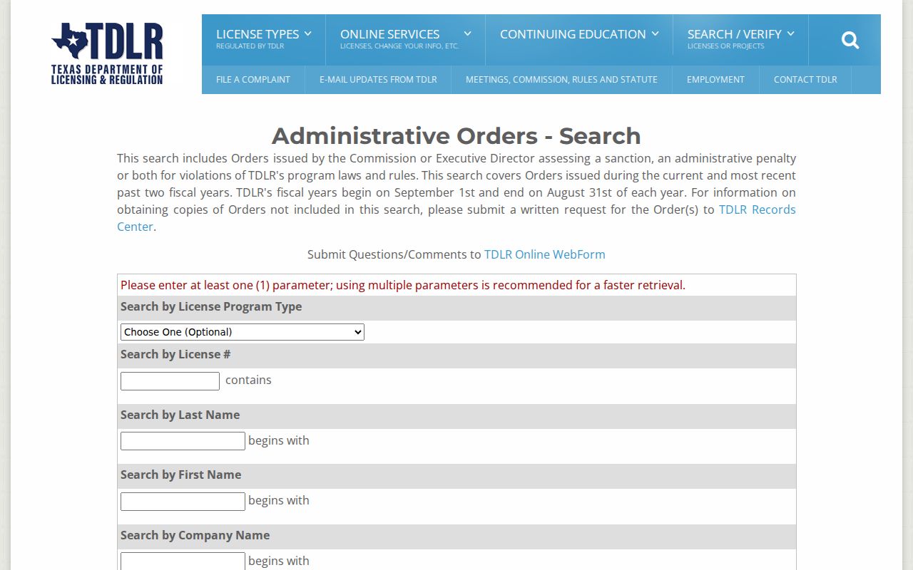
The TDLR image demonstrates the ZIP-equal option in its own record system. Interpret a result as an agency licensing record and verify any license directly with the issuing board. A professional mailing address is not necessarily a home address.
Garland ZIP Code Definitions
Postal labels are easy to overread when they are copied into property or directory notes. Use the terms below consistently so a ZIP code directory entry stays a location aid rather than a claim about a person or legal jurisdiction.
- ZIP code
- A postal routing code associated with delivery geography. It does not establish a city limit, county, parcel boundary, or current resident.
- ZIP+4
- An added four-digit delivery segment used with a ZIP code. Obtain it from USPS for the exact address rather than inferring it from a city map.
- PO Box ZIP
- A ZIP used for post-office boxes. It describes box delivery and should not be treated as a street-address area or residence finding.
- Carrier route
- A postal delivery-routing grouping. A route relationship can change without changing a municipality, county, or household.
Garland ZIP Code Map Checks
For a reproducible ZIP check, preserve both postal and civic evidence. Start with the exact USPS result and date. Compare it with the official ZIP map and the City Limits map. Then inspect the DCAD account or the appropriate Collin CAD record and use MyGarland’s parcel, address, street, and city-limit layers for local context. MyGarland’s map is expressly approximate and is not a legal survey, so pair it with the appraisal and recorded-document routes when property boundaries matter.
After ZIP geography is settled, a street-level record trail may use the Garland by-street directory for the address workflow. That follow-up starts with the exact number, direction, street name, and street type. It does not convert the ZIP into an occupant list.
Note: Save the returned ZIP, lookup date, map layer, county, and record role so another researcher can repeat the same geographic check.
Garland ZIP Code Historical Addresses
ZIP changes and city labels can complicate older Garland address research. A historical directory, newspaper, or deed should be read with its publication date and street information intact. Do not replace its printed postal label with a current ZIP just because a modern lookup returns something different. First test the street against the date, city label, and any available parcel or legal description, then use bulletin history only as a possible routing explanation.
UT Austin’s Garland Telephone Directory citation covers a run from 1955 through 1999 with gaps and includes Garland, Dallas, Mesquite, Plano, Rockwall, Rowlett, Sachse, Sunnyvale, Wylie, and nearby communities. A city label in that collection is therefore not a city-limit ruling. The 1961 R.L. Polk Dallas directory is another greater-area source. Read a page image, its publication year, and the stated geographic scope before joining its address to a modern ZIP result.
Central Library’s local-history resources, city-directory collections, and newspaper microfilm can supply dated household clues. The county recorder and appraisal district provide different forms of property evidence. Pairing a directory image with a deed legal description is stronger than relying on a ZIP alone, especially near city and county edges where mailing, assessment, and municipal boundaries do not line up.
Note: Keep the historic ZIP exactly as printed, then record the current USPS result separately with the date it was checked.